A Nomad's Guide to Exploring Sierra Norte, Mexico
In the southwestern Mexican state of Oaxaca, the Sierra Norte has everything you need for outdoors adventure: hiking, biking and horse-riding trails, stupendous scenery – and the knowledge that you are helping to protect it for those who live there and for others to enjoy.
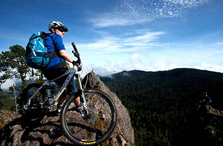 Photo © Expediciones Sierra Norte
Mexico’s fifth largest state, Oaxaca is also one of its poorest, but it is rich in diversity, both topographical and cultural. It’s crossed by three mountain ranges and, as a result, its peoples, having grown up separated by a multitude of natural hazards for a considerable time, are astoundingly various. At last count, the National Institute of Statistics and Geography reckoned the state was home to 16 indigenous groups, each with its own customs, traditions, and language.
I got to know Oaxaca and its plethora of peoples well in the four years I was based as a journalist in Mexico: I worked door with a Mixtec boxer at a rowdy bar in the state capital; lost countless hands of conquian – an early form of rummy – to Huave fisherman in San Mateo del Mar; and was apprenticed to a Mazatec shaman, who taught me how to make ceremonial use of the psychoactive fungi and plants that grow near the Cañada town of Huautla de Jiménez.
The Sierra Norte, a place of cloud-forested mountains and maguey scrubland just under two hours from Oaxaca City, left arguably the deepest impression on me. It is where eight remote Zapotec villages, the Pueblos Mancomunados (San Miguel Amatlán, Benito Juárez, Cuajimoloyas, La Nevería, Santa Catarina Lachatao, Latuvi, Llano Grande, and Santa María Yavesía) came together to protect their land against rogue developers and deforestation and provide themselves with a living from ecotourism. (The Zapotecs are the descendants of the founders of the pre-Columbian civilization that built the metropolis of Monte Albán some 2,750 years ago.)
Ecotourism in the Pueblos Mancomunados
Each of the participating villages has a staffed office to receive travelers and clean clifftop cabañas with fireplaces, showers with hot water, and hammocks to swing in as you take in the views. Guides are available, and meals are offered in the village comedor or occasionally in people’s homes. To connect with Zapotec culture, take part in a temezcal “sweat lodge” ceremony overseen by a curandero (my pores have never been wider) or learn how to brew “the drink of the gods”, pulque, an alcoholic libation made from fermented agave nectar.
The villagers have created a 62mi (100km) network of ways to hike, bike, and ride horses across the Sierra Norte. Elevations in this high country range from 7,270ft (2,200m) to over 10,000ft (3,200m), and the environment, with dense oak and pine cover, canyons, caves, waterfalls, and panoramic lookouts, is spectacular.
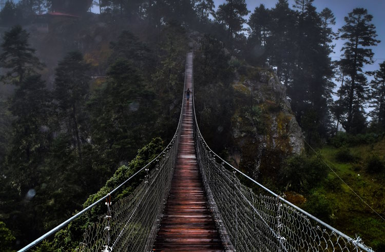
And it is, even to this keen naturalist, barely believably biodiverse. Its closeness to the Isthmus of Tehauntepec, the narrowest stretch of land separating the Gulf of Mexico from the Pacific Ocean, makes it a convergence point for several major bird migration routes and it has acted as a funnel for animals, as well as plants, from the north and south for millions of years. Today, the ecoregion, due to its varied climate and landscape, is a mosaic of different habitats, with very few vacancies.
Ferns, bromeliads, and agaves give the underbrush a lush, prehistoric feel; the canopy is shared between 15 species of oak, 12 of pine, the red gum and remiendo; and bursts of color come from orchids, lobelias, and magnolias. But the Sierra Norte isn’t only beautiful, it is bustling.
My binoculars rarely left my face. I bagged a mountain trogon, berylline and azure-crowned hummingbirds, an elegant euphonia and restricted range species – the Tamaulipas pygmy owl, dwarf jay and gray-barred wren. Their predators include the margay and ocelot, the first being an exceptional climber, and pumas stalk the red brocket and white-tailed deers that you’ll get used to seeing. And bear in mind that the Oaxacan pygmy rattlesnake is just as venomous as its bigger brothers.
Safety in the Sierra Norte
The US travel advisory for Oaxaca is “exercise increased caution” – to take the same precautions that anyone sensibly would when it comes to getting around, keeping your valuables out of sight etc. Once you're in the Pueblos Mancomunados, you'll be traveling among locals whose generosity is legendary. Should you decide to hike or bike it alone, the trails, which range from easy to challenging, are well marked. I’d recommend going with a Zapotec guide, who’ll know the best places to go for what you want to see.
Disease
There have been small outbreaks of malaria in Oaxaca state, mostly in the lowlands and resorts of Puerto Escondido. It's not a problem at higher altitudes, where temperatures are cooler, and therefore mosquitoes less of a risk.
Climate
It can get very cold at night at the higher altitudes, so always pack extra layers and a jacket for the evenings – regardless of how warm it feels during the day.
Altitude
The highest parts of the Sierra Norte rise to 10,000ft (3,200m) above sea level, so it's important you understand the symptoms and seriousness of altitude sickness. Acute mountain sickness (AMS) can strike when you're above 8,200ft (2,500m). It can cause shortness of breath, nausea, headaches, blurred vision, loss of appetite, and disorientation. It can develop very quickly and be deadly in extreme cases.
Trip notes
Book your trip with the Zapotec-owned and -operated Expediciones Sierra Norte. The company will provide you with maps and bus timetables to get to your starting destination. If you are traveling outside of holiday periods or on weekdays, you can generally turn up to any of the villages (except the two most remote ones), find the local office (they're open 9am–9pm), pay your fee, get a map, meet your guide, and set off.
Related articles
Simple and flexible travel insurance
You can buy at home or while traveling, and claim online from anywhere in the world. With 150+ adventure activities covered and 24/7 emergency assistance.
Get a quote


No Comments