The world’s largest freshwater lake, Lake Superior offers natural wonders equal to its size. Joe Furey shares his journey along the Canada side of the lake, where he hikes, fishes, explores rugged islands, and basks in the beauty of this little-visited wilderness.
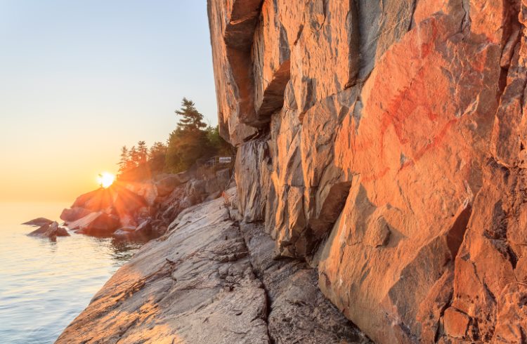 Photo © Getty Images / gqxue
When we think of a North American road trip, there’s a tendency to limit it to Route 66, the Blue Ridge Parkway, and the Pacific Coast Highway – and when the Great Lakes come to mind, our imaginations rarely venture north of the US border. Well, we’re missing out: one of my favorite drives takes a road less traveled, Highway 17, aka the Trans-Canada Highway, which cleaves to the Canadian shore of Lake Superior, and takes in some of the most exciting – and little seen – frontier country in the region.
- Fall colors in Agawa Canyon
- Lake Superior Provincial Park and Pukaskwa National Park
- Waterfalls and islands
- On to Thunder Bay
- Trip notes
Fall colors in Agawa Canyon
I started my journey in Sault Sainte Marie (SSM), Ontario, in mid-September, preferring to drive Highway 17 east to west – because there’s something suitably climactic about finishing a 450mi (724km) drive in a city called Thunder Bay.
SSM, or “the Soo”, sits on St Mary’s River between lakes Superior and Huron and is one of the oldest communities in the upper Midwest: Whitefish Island was a First Nation Ojibwa settlement more than 2,000 years ago, and a Jesuit mission was founded there in 1668.
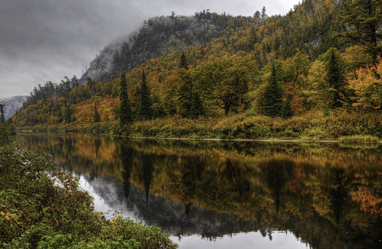
An avid leaf-peeper, I parked up almost as soon as I set out, taking the 114mi (183km) Agawa Canyon Train Tour north into a nature reserve for some of the most vivid and varied fall foliage – so vivid that it gave birth to a Canadian school of impressionistic landscape painters, the Group of Seven, in the early 1920s; and so varied you’ll be coming up with new names to sit alongside auburn, carmine, and gamboge on September’s color wheel.
Lake Superior Provincial Park and Pukaskwa National Park
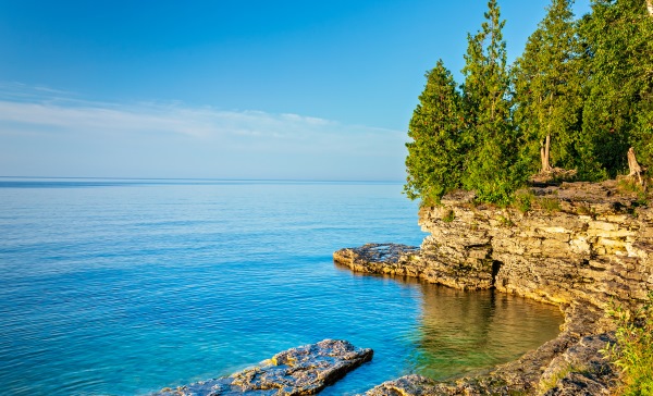
The following morning I took off for the 600mi2 (1,553km2) Lake Superior Provincial Park, stopping at Gargantua Harbour, where an old logging and fishing village has all but evaporated, but the Ojibwe still make camp (Batchewana First Nation refers to this region of their unceded traditional territory as Nanaboozhung). I also dropped in on the Agawa Rock pictographs – Mishipeshu, the Great Lynx, and 100 or so other images – that the Ojibwe painted, with red ochre and animal fats, onto a 15ft (4.5m) face of granite overlooking Lake Superior. Mind your footing – it’s slippery, and according to Selwyn Dewdney, the “father of rock art research”, Mishipeshu is the “sinister deity of swift or troubled waters”.
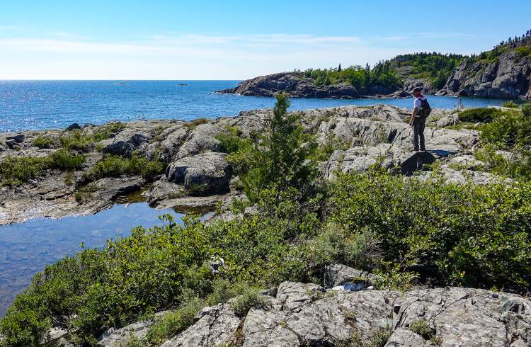
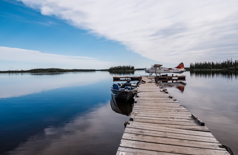
From here, the highway heads northwest, through the former fur trading post of Wawa, and peels away from the lakeshore to leave Pukaskwa National Park, a parcel of untouched boreal wilderness with a rich Anishinaabe First Nations cultural history, to its own devices. Its 37mi (60km) coastal hiking trail, occasionally punctuated by appearances from black bear, timber wolf, and Canada lynx, is best tackled one way – you can catch a water taxi back to the south end of the trail.
Waterfalls and islands
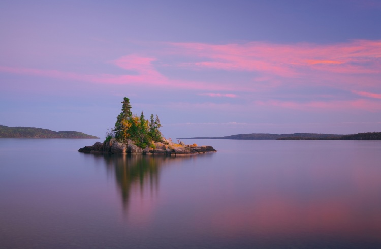
The highway starts to climb, and the drama of the drive to intensify, once you’re past the town of Marathon. At Aquasabon Falls and Gorge, near Terrace Bay, and Rainbow Falls Provincial Park, a few miles shy of seasidey Rossport, nature takes a turn for the seriously sublime. The islands of Lake Superior cluster about its northwest corner, so there is offshore magnificence to contend with, too.
A friend took me for a bob around those islands – the Rossports, Simpsons Island, the Fluor island group – in an aluminum fishing boat. They’re popular with kayakers for their cobble beaches, sea arches and caves, and intricate basalt formations, as well as shipwrecks, lighthouses, and rugged walking trails. Back in the 70s, when it was decided that no country had claimed it, the St Ignace archipelago – of which, St Ignace is Superior’s second-largest lake island – was fancifully designated the Republic of Nirivia, and given its own flag, anthem, and national flower.
The whole area comes under the protection of the Lake Superior National Marine Conservation Area, the largest freshwater reserve in the world, which means the caribou, osprey, moose, loon, and bald eagle that call it home can rest easy.
On to Thunder Bay
At Nipigon, I parted company with Highway 17, heading down Highway 11, but not before I’d done some fishing. In the fall, the Nipigon River, which runs from the Lake to the Bay of the same name, is famously awash with prize fish, including huge brook and rainbow trout, and pink, coho, and Chinook salmon. With the requisite licenses, you’ll be free to unleash your inner grizzly (safe in the knowledge there are no grizzly bears in Ontario).
For all its wild and sonorous name, there’s quite a lot of civilization to return to in Thunder Bay: museums, galleries, arts venues, and cultural centers. Its main attraction is the Fort William Historical Park, a reconstruction of the Fort William fur trade post as it was in 1815, but Thunder Bay is still benefiting from one of its ancestral industries, and that’s mining: gold, chiefly, but also good quantities of palladium and lithium.
Trip notes
For my needs – beauty, culture, a steep plummet in the number of biting insects – fall is the best time to visit the northern shore of Lake Superior, but spring comes a close second. I broke up my journey into four sections, staying twice at campsites with decent facilities (which are commonplace) and twice in guest houses. The small towns of the region don’t lack for places to stay and eat. Sault Sainte Marie, Michigan, is your port of entry to and from the US, and the Soo is served by an international airport, with connecting flights to Toronto and Thunder Bay.
Related articles
Simple and flexible travel insurance
You can buy at home or while traveling, and claim online from anywhere in the world. With 150+ adventure activities covered and 24/7 emergency assistance.
Get a quote
No Comments