La Guajira Peninsula: Colombia's Road Less Traveled
With towering dunes, remote Indigenous villages, lagoons dotted with flamingos, and stunning, blissfully empty beaches, this out-of-the-way stretch of the Caribbean coast is Colombia’s most spectacular emerging destination.
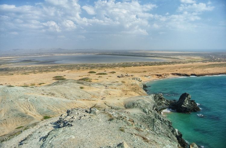 Photo © Getty Images/Kirsten Boos
There once was a time – before guide books, before the internet, before "influencers" – when it was entirely possible for intrepid adventurers to find themselves alone on untouched sands, wildly out of bounds. But stumbling upon such an end-of-the-road Eden required a bit of serendipity and a travel miracle. I'm talking about a detour from a meticulously planned itinerary based on a rumor here, a whisper there, a hand-scratched map stained from the oily hands of a gas station mechanic way back there; the kind of place that fuels coming-of-age narratives in Hollywood films like The Beach and Y Tu Mamá También. The kind of place that, quite frankly, has disappeared.
Or has it?
I’m in one of the jewels of Colombia's Caribbean coast, Cartagena, having drinks with my friend Mathieu, a long-haired, modern-day renaissance man from the French Alps whose enthusiasm is not only infectious, but downright persuasive. My job as a travel and entertainment journalist often collides with Mathieu's gig as an ecotourism operator specialized in Colombia's lesser-known gems. The results have always been magical. So, when Mathieu tells me of such a place – post-guide books, post-internet – I'm inclined to listen. He tells me it's called Punta Gallinas; and what transpires next unravels just as it always does on the silver screen.
"It's the northernmost point of South America," he tells me. "There is nothing there but a few Way'uu families, who offer you a hammock to sleep in and cook fresh lobster for you. Flamingos trounce around like they own the place. It's a no man's land of intense beauty only charted by gas smugglers who bounce between the Guajira Peninsula and the nearby border with Venezuela. It's edgy, man! And the beach! The beach!"
- Santuario de Fauna y Flora Los Flamencos and Riohacha
- Cabo de la Vela
- Playa del Pílon
- Macuira National Natural Park
- Punta Gallinas
- Trip Notes
Santuario de Fauna y Flora Los Flamencos and Riohacha
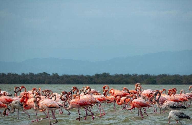
The first clue that something is different appears along the Caribbean coast around 15mi (25km) or so south of Riohacha. Santuario de Fauna y Flora Los Flamencos is a 27mi2 (70km2) coastal nature reserve sitting 1.8mi (3km) off the main road, unbeknownst to most. Here some 10,000 or so rose-colored flamingos dot multiple lagoons like scrums of pink peppercorns on the horizon. Mathieu gives me a wry smile. "I told you so," it says.
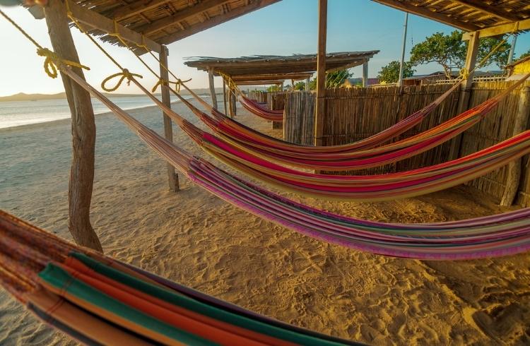
Riohacha feels like a frontier town. Located 242mi (390km) northeast of Cartagena, it offers a mix of modern shopping malls and crumbling colonial cathedrals that yield to a palm-lined waterfront. Makeshift stalls serve fresh shrimp ceviche to local families and artisans hawk colorful chinchorros (traditional Way'uu hammocks), a tool for local respite that becomes more and more a fixture of the landscape as you venture further northeast.
Cabo de la Vela
Customarily, Riohacha was the end of the line. Continuing on to the Middle and Upper Guajira means navigating unpaved roads and potentially tricky situations. The indigenous Way'uu people run things their way, suspicious of outsiders (both tourists and law enforcement). Makeshift toll booths run by children demanding ransoms – usually food or candy but money works, too – are frequent. It's the Wild, Wild Northeast.
The landscape shifts on approach to Cabo de la Vela. The dense greenery that unravels across the Sierra Nevada de Santa Marta mountain range into the Caribbean's cerulean sea becomes but a speckle in the rearview mirror, substituted instead for sunburnt desert plains and towering sand dunes that glow rust-orange when the light hits it just so.
Located 99mi (160km) northeast of Riohacha, this Way'uu fishing village – Cape of Sails in English – takes its name from its trademarked winds that have long attracted kite surfers to these remote shores (get on the water with Kite Addict Colombia). As a far-flung base for La Guajira's mesmerizing surrounds, it's the kind of place we all thought was a thing of the past.
While there was once just a Way'uu family or two offering hammocks to visiting kite surfers, the village has become an ecotourism hotbed thanks to government tourism initiatives. Way'uu families now offer a range of lodging for visitors, though rusticity remains the rule (a $3.4 million government project to bring electricity to the Upper Guajira was only kicked off in 2021). Despite its evolution as a destination, it still feels well out of bounds.
We are welcomed with open arms with grilled lobster and red snapper, prepared camping-style over hot coals, the fruits of indigenous fishing techniques perfected over centuries. We sleep in wide chinchorros without a care in the world.
Playa del Pílon
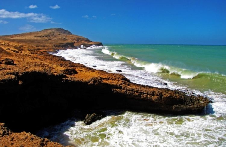
Located 2.5mi (4km) north of Cabo de la Vela, this idyllic beach characterizes the shock and awe of the Upper Guajira – its low, rocky cliffs flank a floury patch of reddened sand and aquamarine waters with the 328ft (100m) Pílon de Azucar, a pyramid-shaped hillside, looming in the distance. It should be packed with people, but it's empty. If I had signed on to a beach vacation on Mars, I'd have imagined this.
Macuira National Natural Park
The eastern side of the Upper Guajira is mostly preserved by Macuira National Natural Park, a 96 mi2 (249km2) cloud forest oasis that protects sand dunes, forest ecosystems, and 140 different bird species (17 of which are unique to the park). There is extraordinary hiking here – watch out for some 15 species of indigenous snakes! – both among the dunes and across the Serrania de la Macuira mountain range within the reserve. The latter provides La Guajira's only natural water resource, which accounts for the park's sacred status among the Way'uu communities who call it home.
Punta Gallinas
Everything culminates at Punta Gallinas, South America's most northernly point. It’s accessed via Bahía Hondita, an impossibly emerald bay flanked by mangroves and blood-orange cliffs that would be dazzling enough in and of itself – but it's just the prologue. The landscape here is harsh but spectacular. A handful of Way'uu families call this desertscape home, their herds of goats wandering freely alongside wayward flamingos.
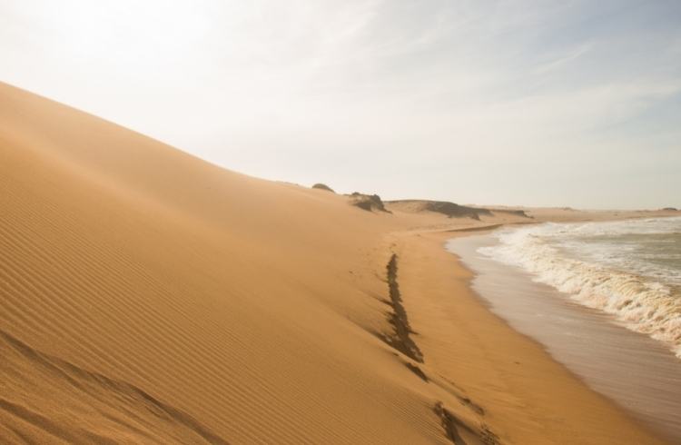
As we make our way to the top of the continent, the vibrant green vegetation abruptly gives way to looming sand dunes, some as high as 200ft (60m). I know the Caribbean lies beyond, but we can't see it. As we lumber up and crest the dune, the turquoise seas of the Caribbean begin to blindingly glimmer. The dune drops off like a shifting cliffside with the sand collapsing into the sea below. I have never seen anything like it. This is Toroa Beach. We have it all to ourselves.
It's the kind of place movies are made about.
Trip Notes
Getting there: Riohacha, 106mi (172km) northeast of Santa Marta, is the jumping off point for trips deeper into the Guajira Peninsula and can be reached by long-distance buses from Cartagena, Barranquilla, and Santa Marta as well as buses and flights from Colombia's capital, Bogotá. From there, the difficult terrain is navigated in 4WD jeeps via an organized tour with a local ecotourism agency such as Kaí Ecotravel. (Foreign visitors are not advised to travel here independently.)
When to go: March, May, August, and September hit the sweet spot between good weather (October and November are rainy) and fewer crowds (December to February and June-July can get relatively congested).
Accommodation: Rustic Way'uu huts made from yotojoro (the inner core of the cardon cactus) are the rule of thumb here. Sleeping arrangements are generally hammocks, chinchorros (larger, warmer hammocks) with shared bathrooms, or beds with private bathrooms (though running water is hard to come by).
Related articles
Simple and flexible travel insurance
You can buy at home or while traveling, and claim online from anywhere in the world. With 150+ adventure activities covered and 24/7 emergency assistance.
Get a quote
No Comments