Thinking of taking the epic journey along the East Coast of Australia? Nomad Raquel did the drive in a motorhome, and she shares her itinerary and her tips on where to stop along the way.
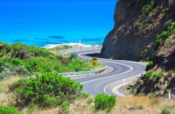 Photo © iStock/neoellis
After more than 10 years of traveling, I finally got the chance to explore the Australian east coast by motorhome.
Australia is the perfect country for a road trip – the roads are excellent, the country is full of great campgrounds, and the nature is unbelievably inviting.
- Best way to travel around Australia
- How much time to allow to see Australia
- Itinerary for your East Coast road trip
- Australia road trip safety tips
Best way to travel around Australia
I did it in a motorhome which allowed me to travel at my own pace while exploring everything I wanted to see.
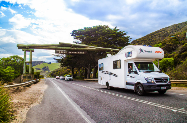
You can rent a car (or buy a car if you're here for a while), but traveling by motorhome will give you more freedom and comfort in terms of picking where to stay, the sudden need for a bathroom in the middle of nowhere, and cooking your own food.
If driving isn't an option, or if you're traveling solo, check out bus tours. Compare prices and find the operator that's right for you, but a few options include Greyhound and Contiki.
How much time to allow to see Australia
Australia is a huge country. If you were to drive the entire coastline, you’d cover a total of 16,155mi (26,000km). This is why most travelers choose to drive the east coast. The route covers 2,610mi (4,200km) from the Great Ocean Road (near Melbourne) to Cairns, the best base to explore the Great Barrier Reef and Daintree Rainforest.
Give yourself at least a month. Trust me – the east coast has a lot to offer, and you will want to spend a number of days at each destination. My original plan was to drive all the way to Cairns, and though I ran out of time to do that, it was worth exploring along the way.
It’s also important to rest three to four days for every 10 days of travel. Rent a place, leave the motorhome for a while, enjoy a bit of comfort, and live like a local. This will renew your energy to continue the long journey.
Itinerary for your East Coast road trip
My itinerary went like this, and it worked well – so feel free to be inspired.
1. Wilsons Promontory National Park and The Great Ocean Road
Time to allow: seven days
Distance: 310mi/500km
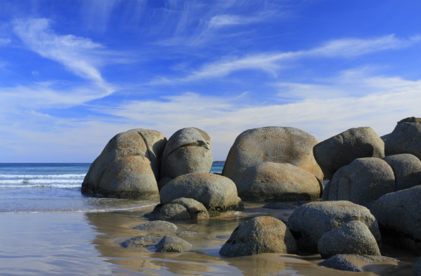
Just 3hrs southeast of Melbourne, Wilsons Promontory is the place to go for nature and wildlife, especially kangaroos, wallabies, and wombats.
We spent four days at Tidal River campground. Choose a campsite near the beach to be nice and close to the waves. Not too far away, be sure to check out Squeaky Beach, which is easily reached by car and a 328-yard (300m) walking trail.
If you enjoy hiking, dedicate three hours of your day for the walk to Sealers Cove. The reward is a spectacular golden beach with crystal-clear water.
Backtrack to Melbourne and head southwest to Torquay – the official start of The Great Ocean Road – a spectacular 155mi (250km) stretch of road along the southern coast of Victoria.
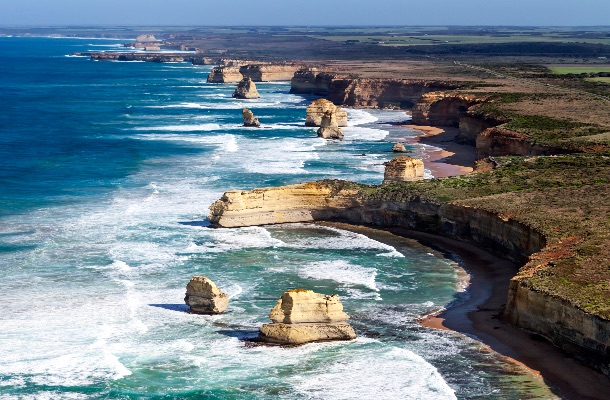
Drive the Great Ocean Road slowly – it hides more secrets than you could imagine. Surfers shouldn’t miss Bells Beach, home of the Rip Curl Pro Surfing Competition since 1960. Next, look for Kennett River. where you might spot loads of koalas hanging in the trees.
The Twelve Apostles are also a must (rock monoliths which stand in the ocean just off the coast – although there are technically only eight, they're still spectacular). There are many lookouts in the area, but for beach access, Loch Ard Gorge was my favorite. We spent the night at the Apostles Camping Park.
The Great Ocean Road ends close to Warrnambool, where you can turn back and do it all again, or take the inland road back to Melbourne via Geelong.
2. Melbourne to Sydney
Time to allow: four days
Distance: 684mi/1,100km
You could drive straight up the Hume Highway in about 10 hours, but you’ll miss everything along the Federal Highway – which goes through Canberra, the capital city of Australia. Here you'll find the National Gallery of Australia, the Australian War Memorial, Parliament House, and Questacon The National Science and Technology Centre. Once you've checked out Canberra, head to the coast and stop off in Batemans Bay, a lovely coastal town with a snorkeling trail.
About 62mi (100km) north of Batemans Bay is our favorite part of New South Wales, Jervis Bay.
Here, you’ll find Booderee National Park, Hyams Beach – which is renowned for having the whitest sand in the world – Cave Beach, a surfers’ favorite, and Green Patch, a beautiful beach and campground in Booderee National Park. All of these beaches are close, along a 13mi (22km) stretch of road.
There's great camping at Cave Beach, but cars are not allowed and the car park is about 300m away, so, you have a trolley to carry your camping gear in and out of the campsite.
About 31mi (50km) away, see Honeymoon Bay, which is opposite to Hyams Beach, still in Jervis Bay. The water is calm here, perfect for kids and a bit of relaxation.
On hot days, find the rock pools at Kiama, about 49mi (80km) north. Here, you'll also see the famous Kiama blowhole, which, depending on the conditions of the ocean, can spray water 82ft (25m) into the air.
Another 55mi (90km) north, head into the beautiful Royal National Park (AU $12 per vehicle, per day). Drive to Wattamolla Beach, where there’s a waterfall and a river with unique scenery. There are cliffs here where travelers and locals jump into the water – however, there have been many incidents of people getting seriously injured. Be careful.
If you want to see Figure Eight Pools – rock pools forming perfect, impressive, figure eights – you’ll need around three hours for the hike, so bring lots of water. Start the hike at Garawarra Farm car park (6mi/10km south of Wattamolla). Always check the tides before you go, never attempt to explore the rock pools during high tide. Again, many injuries have occurred down here. Use extreme caution and only attempt to go at low tide, when surf conditions are flat. Follow the rocky path by the ocean, and watch out for big waves that might be on the horizon – never turn your back to the ocean, and never go alone.
3. Sydney
Time to allow: five days of relaxation
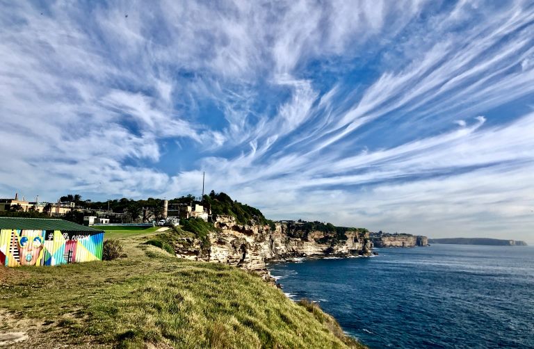
Sydney is an hour north. Don't miss the Coastal Walk from Bondi to Coogee, which takes in lovely beaches, and views along a clifftop walk. Spend a day at Manly Beach – take the 22-minute ferry from Circular Quay.
The journey on the ferry is a highlight, as you bump along the waves with views of the Harbour Bridge, the Sydney Opera House, and Sydney's many harbourside suburbs, many with beautiful houses.
4. Sydney to Gold Coast
Time to allow: five days
Distance: 497mi/800km
This is the Legendary Pacific Coast.
Just a 90-minute drive north of Sydney is the Central Coast region of NSW known for its beaches and small coastal towns. While there, don’t miss a walk in Bouddi National Park, or, if you’re into wineries, head northwest into the Hunter Valley, just an hour north, a great destination for food and wine.
We stayed on the Pacific Highway and kept going north to Port Macquarie (236mi/380km north of Sydney). Once there, we found a campground and did the 5.5mi (9km) coastal walk from Town Beach to Tacking Point Lighthouse. The walk offers beautiful beaches and views of Port Macquarie. Plus, we saw whales frolicking offshore!
While driving north, we came across the Belwood Park in Nambucca Heads. This wasn't on our itinerary, but we couldn't ignore it. The Nambucca River offers such clear water that we couldn't stop ourselves from spending a few hours in the area. My advice is to have a picnic and go for a swim before getting back on the road.
After another 167mi (270km) drive, you’ll reach Lennox Heads – a mecca for surfers – and a little further away, famous Byron Bay.
Both towns are laid back, but Byron has a more alternative, hippie vibe. It’s one of the most popular destinations in Australia, and you've got to see it for yourself. If you're spending time in Lennox Head, don't miss Pat Morton Lookout where you'll see hang gliders and paragliders taking off.
In Byron Bay, grab a burger at the Beloporto – a local’s favorite. Don’t miss Watego's Beach, Tallow Beach, and the Cape Byron lighthouse – which is the furthest easterly point on mainland Australia. If you’re there around Eastertime, don’t miss the Byron Bay Bluesfest.
We camped at the North Coast Holidays Park, a campsite within walking distance to town and with direct access to Clarkes Beach.
Remember to secure your food while camping or bush turkeys will visit to inspect your supply of food. Never feed the local wildlife.
5. Gold Coast, Brisbane & Moreton Island
Time to allow: six days
Distance: 50mi/80km
From beaches to waterfalls, hikes, and mountains, the Gold Coast area offers it all.
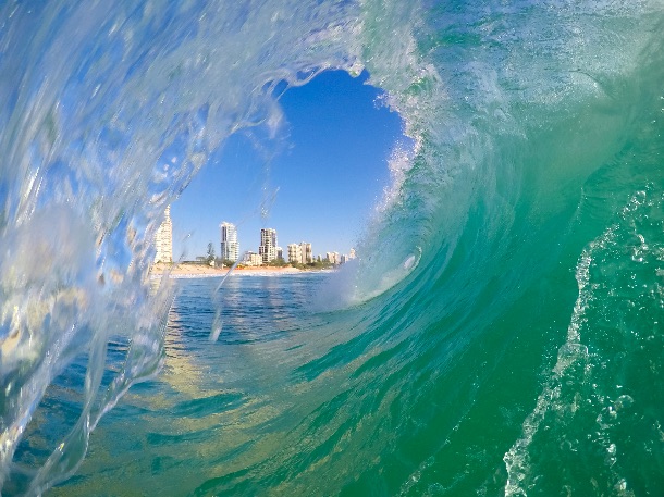
Explore Springbrook National Park and check out Cougal Cascades for a swim, easily accessed by stairs.
The Killarney Glen Falls, located in Canungra, 21mi away (35km) are a hidden treasure. This is a heart-shaped waterfall, but it’s in a military area so check in advance to see if access is closed – call Canungra Information Centre for updates. If it's been raining, the clear blue water will become murky from the runoff, and won't be so pretty. To get there, search "Marian Valley, Beechmont Road" on the GPS. A car park is just out front.
Another beautiful destination, not known by many travelers, is Moreton Island. Drive to Brisbane (49mi/80km from the Gold Coast) and take a catamaran from the Port of Brisbane. It takes about 75 minutes to get to the island. Go snorkeling around the Tangalooma Wrecks, where there are 15 vessels to explore underwater.
Tallebudgera Creek, approximately 30 minutes from Surfers Paradise, is a great place for kids and stand up paddleboarding, thanks to calm waters.
Keen surfers shouldn’t miss Mermaid Beach and Coolangatta, while kite surfers should explore Narrowneck.
6. Sunshine Coast, Fraser Island & Town 1770
Time to allow: six days
Distance: 373mi/600km
Head north of Brisbane toward the Sunshine Coast and on to Noosa Heads, a beautiful destination on the east coast. Try a stand-up paddleboarding experience from Main Beach to Tea Tree Bay, a must for anyone who loves the water.
Take the coastal walk to Alexandria Bay, and check out the Fairy Pools, often missed since they can't be seen directly from the trail, To access Fairy Pools, pay attention to a bench close to a sign reading "warning - unfenced cliffs", right after Picnic Cove. Leave the trail and walk toward the ocean over the rocks, a quick three-minute detour.
Note: be careful, many accidents happen when people go too close to cliffs – hence the sign.
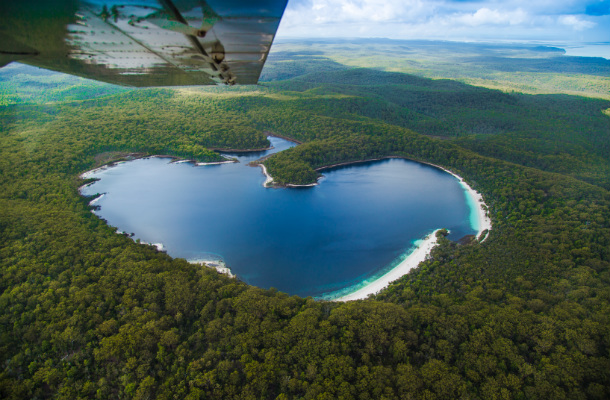
You need a high-clearance 4WD to access Fraser Island, so leave the motorhome behind and go with a local tour operator. We took a two-day tour, departing from Rainbow Beach (80mi130km north of Noosa). You can also join a tour at the nearest town, Hervey Bay – which is also where you can organize whale watching tours.
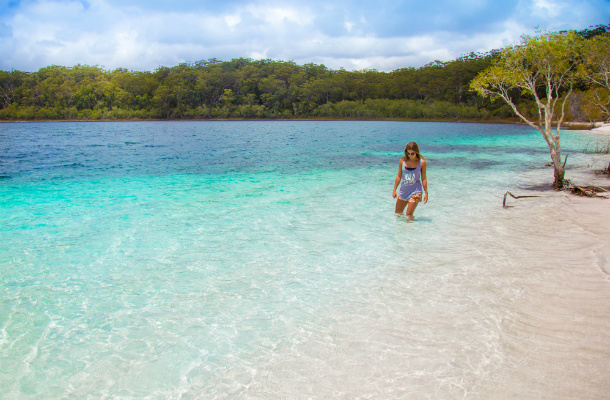
On the island, check out Lake Mackenzie, Champagne Pools, Central Station, and see Indian Head Lookout for spectacular views. You might see sharks, stingrays and turtles through the crystal water. Prepare your zoom lens on the camera for epic shots.
If you've got cash to spare, enjoy a 15-minute scenic flight over Fraser Island. You get to see the forest and the lakes from above, and you'll find out Lake Mackenzie is actually heart-shaped when viewed from the air.
7. Town of 1770 and Lady Musgrave Island
Time to allow: two days
Another 155mi (250km) north of Hervey Bay is the town of 1770. The village was renamed 1770 in 1970, to commemorate the bicentenary of Captain Cook’s landing there.
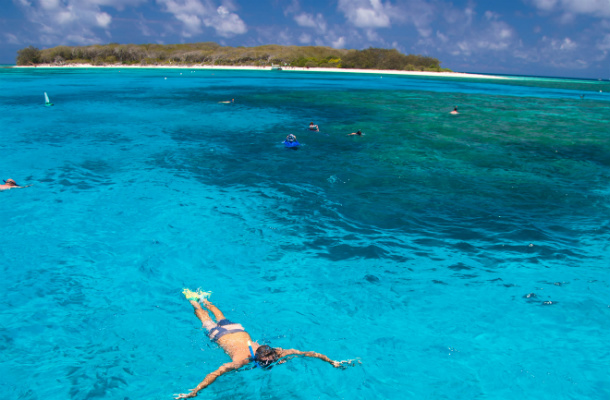
Take a one-day boat cruise to Lady Musgrave Island, which departs from the 1770 Marina. Go snorkeling to see turtles, coral reefs, and many species of fish beneath the clear water. If you'd prefer to go scuba diving, just know the reef isn't far from the surface of the water, so you might be wasting your money.
If you get seasick, think twice before going – the boat trip out to the island is quite a bouncy adventure.
8. 1770 to Airlie Beach
Time to allow: one day
Distance: 435mi/700km
On the nine-hour drive from 1770 to Airlie Beach, you’ll pass through Rockhampton, the administrative capital of central Queensland. The town sits in the Tropic of Capricorn, but is inland from the coast, so it’s incredibly hot. It’s also the center of beef production in Queensland, and it claims to be the home of Australia’s best steak.
9. Airlie Beach and Whitsunday Islands
Time to allow: four days
Airlie Beach is the jumping-off point to explore the Whitsunday Islands. We took a three-day cruise, but if you have the skills (and the money) you can charter your own yacht.
Whichever way you explore the Whitsundays, be sure to check out Whitehaven Beach. With clear-blue water, white sand, and stunning scenery, there's no surprise this is printed on postcards for Australia.
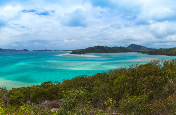
Note: From Whitehaven Beach, there's a trail leading to a scenic lookout. Check the tides before you go to the lookout, as right between high and low tide is the best time to see the water mixed with the sand. If the tide is low, there won't be much water, so you'll see a shade of green instead of blue. During high tide, the water hides a lot of the white sand. In between is perfect.
Taking a scenic flight to the Great Barrier Reef might set you back a bit of money, but seeing the heart-shaped reef, and all the corals beneath the surface, is surreal from above. Compare prices and tour inclusions, but your options are helicopter, small plane, or seaplane. Or, if you’re brave, consider taking the aerobatic flight.
Sadly, our trip ended in the Whitsundays, as we ran out of time.
If you're a keen scuba diver and want to see more of the Great Barrier Reef, drive further north to Cairns and check out the tour operators in town. Word of warning: you might never want to leave – there's a reason Cairns' bars are staffed by people from all over the world.
Cairns is a 380mi (610km) drive, or a one-hour flight from Airlie Beach.
Australia road trip safety tips
Australia is one of the safest countries in the world. As a woman, I felt safe enough to easily travel solo around the country. You should always have some safety tips in mind, including; sleep in established campsites or accommodation, don't walk alone in dodgy places late at night, let a friend or family member know your itinerary, and send them regular updates. Avoid touching, feeding, or tampering with local wildlife – Australia's natural ecosystems are pristine, and shouldn't be messed with.
- Although taking a road trip is great fun, in Australia it will take you a long time to get from one place to the next. Allow a sufficient amount of time to rest on longer stretches of road, and stay alert if you're driving at dusk and dawn, when Australia's wildlife are most active. At night kangaroos will bounce right in front of your vehicle, so be aware of any animals beside the road.
- Road safety in Australia is taken very seriously. Speed limits are strictly enforced. Obey them, or else be prepared to pay a hefty fine, as speed cameras and police are everywhere.
- Road conditions are excellent and well marked, but a GPS will come in handy to be sure of where to go. There are signs reminding you to "drive on left", as well as "Stop, Revive, Survive" billboards, encouraging you to take a break.
- Never assume fuel will be readily available or easily accessible when traveling far from major cities. Even though we didn’t have trouble during our journey, I’d advise you to refuel whenever the opportunity arises.
- Respect the wildlife you encounter on your trip. Kangaroos are cute, but may be violent – never approach them for a selfie or with food.
- Take good care of your motorhome. It's your home. Keep it clean and tidy.
- Don’t stop anywhere you want – it’s not legal. Look for free local maps detailing where rest areas are, and whether overnight stays are permitted.
- Take a look at what time your chosen campground reception closes, it's better to call them beforehand and inform them of your anticipated arrival time. They can always drop keys and instructions in a letterbox for you when you arrive after hours.
- Utilise picnic tables and public toilet facilities along the way – in remote locations, these are great places to stretch your legs and take a break from driving.
- If your driving license is not in English, an International Driving Permit (issued in your home country) is required.
- Pay attention to campgrounds with dump stations, as you'll probably need one every two days if you're in a self-contained vehicle.
- In case of emergency dial 000 or 112. The GSM standard emergency number, 911, won’t work.
- And don't forget, the Australian sun is powerful, wear lots of
sunscreen .
Related articles
Simple and flexible travel insurance
You can buy at home or while traveling, and claim online from anywhere in the world. With 150+ adventure activities covered and 24/7 emergency assistance.
Get a quote

No Comments