4 Amazing US Parks You Probably Didn’t Know About
Planning a US road trip? Want to explore the great outdoors but avoid the crowds at parks like Yellowstone and Zion? These lesser-known parks are more than worthy alternatives.
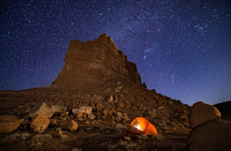 Photo © Getty Images / Adventure_Photo
The National Park Service has been reopening park operations in phases, and a majority of sites are open to visitors, but some facilities may be limited. Before visting a park during the COVID-19 pandemic, find out about its operating status here.
- Goblin Valley State Park, Utah
- North Cascades National Park, Washington
- Great Sand Dunes National Park and Preserve, Colorado
- The Buffalo National River, Arkansas
Goblin Valley State Park, Utah
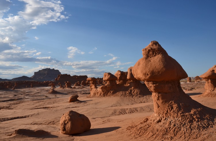
People say that you should visit Goblin Valley State Park if you have kids. I say you should visit Goblin Valley if you want to be a kid. There’s something so delightful about the mushroom-shaped hoodoos that populate Goblin Valley. As you come to the end of the 1.5mi (2.4km) Carmel Canyon trail, you’ll find them bubbling out of the valley floor like a game of Jurassic whack-a-mole. They’re so goofy that they were even the star attraction of a comical fight scene in the sci-fi spoof Galaxy Quest.
The big five national parks in Utah get all the attention, but smaller state parks like Goblin Valley deserve more love. Nearby Arches National Park receives 1.5 million visitors per year, while Goblin Valley receives just 268,000 (not counting the goblins, of course). This allows you to experience similar terrain on a much more intimate scale.
Goblin Valley is located an hour and a half from Arches, making it a good day trip or an easy stopover on the way to Capitol Reef or Bryce Canyon National Parks. There are six miles of trails which lead into and out of the main valley. The valley itself is a large 3mi2 (7.8km2) area ideal for roaming free among the hoodoos.
You can camp inside the state park, but the nearby Bureau of Land Management (BLM) land is better. The undeveloped BLM land near Goblin Valley is so beautiful that it could qualify as its own national park. If you’re self-sufficient (with food, water, tent, and a shovel), you can camp for free. The area is also one of Utah’s Dark Sky Parks. So, when you’re finished playing hide and seek with the goblins, you can set up camp and put yourself to sleep under the stars. - Carol Guttery
North Cascades National Park, Washington
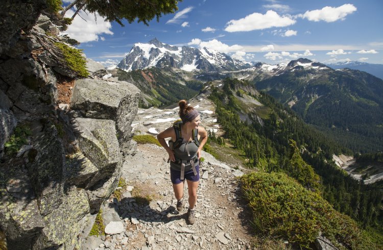
One of the United States’ least-visited parks, North Cascades National Park is a treasure hiding in plain sight. Just three hours from Seattle, its rugged peaks, deep forests, and alpine lakes get passed up for parks with bigger names – and bigger crowds. That means I often have the trails nearly to myself. There’s nothing like a silent hike through mist-shrouded groves of ancient Douglas firs. With an abundance of day hikes, multi-day treks, and the iconic Pacific Crest Trail running through, North Cascades is forest bathing at its best.
Winter in the heart of the Cascade Mountains is even less crowded, and if you’re willing to brave the cold there are more than 300 glaciers to play on. The stillness of a snowshoe walk through the park’s snow-covered fields is just as enchanting as when they are covered in wildflowers.
The park engulfs some 130 glacier-fed lakes. Lake Chelan, America’s third deepest, is one of them. On its crystalline shores is the tiny village of Stehekin and the park-run North Cascades Lodge. Accessible only by foot, boat, or plane, Stehekin is one of those magical places I fantasize about quitting my job for and moving to. Life is slower here – you can take the time to chat with the town gardener over a cinnamon bun the size of your head at the bakery, then rent a bike from the local school teacher. Take it on the shuttle to the top of the road and feel like a kid again careening down the gravel path, all downhill to Rainbow Falls, where the mist sprays your face. Or simply give in to the lull of the lake with some homemade ice cream on the dock and watch the flutter of swallows diving into its shimmering surface. After all, this kind of serenity doesn’t come every day. - Catie Joyce-Bulay
Great Sand Dunes National Park and Preserve, Colorado
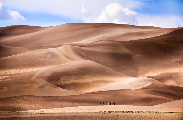
The first time I climbed the Great Sand Dunes in southern Colorado, I couldn’t fully comprehend it. I was in the middle of one of the driest, most land-locked states in the U.S., and I was gazing upon what appeared to be an inverted beach.
I went on a whim, taking the three-hour drive from Colorado Springs with a friend to explore the tallest sand dunes in North America, ever-shifting mountains up to 750ft (230m) high. We tried traversing the sand, zig-zagging up dune after dune, stopping to pant every few steps. The higher we got, the steeper the hills were, and the more they shifted under our bare feet. I started to crawl, digging in hand over hand until I reached an 18-inch (45-cm) ridge that extended across the tops of the dunes.
Below us, the dunes sloped downward and out – they stretched for miles, framed by the snow-topped Sangre de Christo Mountains and the San Luis Valley. How funny it was, to see snow and sand in the same place. I couldn’t stop smiling and spinning my head in every direction, trying make sense of this anomaly of nature.
To get down, we ran and slid through the sand, leaping heel-first to dig in. The sand made the sound of scratching records as we dragged it down with us in rivers, shrieking with joy.
The more I travel, the less often I find myself truly surprised with nature. But I’ve been back to the Dunes at least a dozen times since that first visit, and I’ve yet to grow tired of this playground. I love watching people fly down the dunes on sandboards and sleds, and sharing it with others who’ve never visited before. The climb never gets easier, but even on the 13th trip, the view is always worth it. - Kassondra Cloos
The Buffalo National River, Arkansas
I’m hiking along the 36mi (58km) Buffalo River Trail in north-central Arkansas when a herd of wild hogs stampedes across the trail. A mother hog, followed by four juveniles, dance about on their elegant little hooves for a bit before disappearing just as fast into the forest, startling a white-tailed doe that leaps out of sight as soon as I spot her.
Hiking this trail in the Buffalo River National Park Region always results in tons of up-close wildlife sightings, which is one reason it’s among my favorite national parks and protected areas to visit.
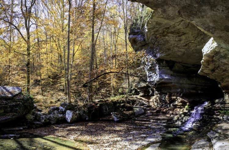
Down below the trail, the Buffalo National River – America’s first national river – flows through a spectacular stretch of the Ozark Mountains, winding between towering limestone bluffs and through oak-hickory forests dotted with caves and hidden “hollers” (v-shaped ravines) that feel as untouched as they must have been centuries ago.
An hour away from Eureka Springs (considered the capital of the southern Ozarks), the park draws locals and visitors year-round. These rolling mountains feature of some of America’s prettiest waterfalls, easy-to-reach campgrounds and cabins, miles of hiking trails, a ghost town, and a variety of canoeing and kayaking adventures.
The Buffalo National River was established in 1972 and is one of the few remaining, undammed, free-flowing rivers in the lower 48 states. The 135mi (217km) river offers challenging rapids and calm spots, but my favorite stretch is the Ponca to Kyle’s Landing section.
Spanning just over 10mi (16km), this section is without a doubt one of the most scenic sections of the river. Big Bluff, one of the tallest bluff faces in America, joins Hemmed-In Hollow, one of the tallest waterfalls between the Appalachians and the Rockies, to make this the perfect kayaking day trip.
While the river steals the show in the summer, I also love visiting in winter, when the leaves have dropped to open up spectacular views of the bluffs. Though the area does get snow and ice, fall and winter are often mild – unlike the crushing, humid heat that ticks love in late summer – and ideal for hiking or cold-weather paddling. - Heide Brandes
Related articles
Simple and flexible travel insurance
You can buy at home or while traveling, and claim online from anywhere in the world. With 150+ adventure activities covered and 24/7 emergency assistance.
Get a quote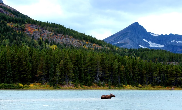
No Comments